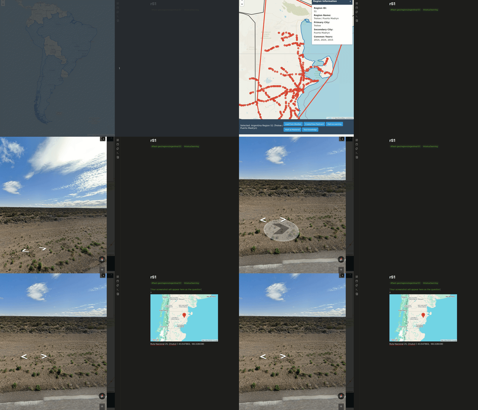
A training tool for Geoguessr that helps you systematically learn regions using natural geographic regions based on Street View coverage data or a traditional chess-like grid system. Integrates with Obsidian for flashcard-based learning.
- Two Region Systems:
- Chess Grid: Divides countries into 8x8 chess-like grids (A1-H8)
- Natural Regions: Creates organic regions based on Street View coverage clustering
- Tracks your learning progress for each region (untouched, learning, mastered)
- Creates markdown flashcards compatible with Obsidian's spaced repetition plugin
- Visualizes your progress on an interactive map
- Estimates completion date based on your progress
- Node.js (v12 or higher)
- npm (comes with Node.js)
- Obsidian with the Spaced Repetition plugin
- Clone or download this repository
- Open a terminal in the project directory
- Install dependencies:
npm install
- Open
server.jsand update theOBSIDIAN_PATHvariable to point to your Obsidian vault's Geoguessr regions folder:const OBSIDIAN_PATH = '/path/to/your/obsidian/vault/Projects/Geoguessr/Regions';
-
Start the server:
npm startThis will start the server on port 3001.
-
Open your browser and navigate to:
http://localhost:3001/ -
The application will automatically load any existing flashcards from your Obsidian vault.
To use the natural regions mode:
-
Navigate to:
http://localhost:3001/natural-regions.html -
Generate region data for a country:
node src/create-regions.js russiaThis will process the Street View data and create approximately 32 natural regions.
Additional options:
node src/create-regions.js russia --regions 48 node src/create-regions.js russia --koppen 0p5 --use-years -
Once regions are generated, they will appear on the map and in the sidebar grid.
- Select a country from the dropdown menu
- Click on a grid cell on the map or in the sidebar
- Click "Create/View Flashcard" to generate a flashcard for that region
- Take screenshots in Google Street View for that region and add them to the flashcard
- Mark cells as "Learning" when you start studying them
- Mark cells as "Mastered" when you can consistently identify them
Flashcards are saved as markdown files in your Obsidian vault with the following structure:
#flash-geo/regions/country-name/A1 #status/learning
![Screenshot of the region]
?
Country Name A1
- Focus on one country at a time
- Start with distinctive regions
- Add multiple screenshots to each flashcard
- Review your flashcards regularly using Obsidian's spaced repetition
The application can use Köppen-Geiger climate classification data to create more meaningful regions:
-
The
map_datadirectory contains Köppen-Geiger data at different resolutions:koppen_geiger_0p00833333.tif(highest resolution)koppen_geiger_0p1.tifkoppen_geiger_0p5.tif(recommended)koppen_geiger_1p0.tif(lowest resolution)
-
When generating regions, include the
--koppenflag:node src/create-regions.js russia --koppen 0p5 -
This will create regions that respect climate boundaries, making them more geographically meaningful.
Note: The Köppen data support requires GDAL to be installed on your system. If not available, the regions will still be generated but without climate data integration.
- Server won't start: Check if port 3001 is already in use. If so, change the port in
server.jsand update all fetch URLs in the HTML file. - Can't connect to server: Make sure the server is running and check browser console for errors.
- Flashcards not loading: Verify the
OBSIDIAN_PATHis correct and the directory exists. - Region generation fails: Ensure that the country's Street View data is in the
map_datadirectory. For Köppen integration, ensure GDAL is installed.
This project is open source and available under the MIT License.
